
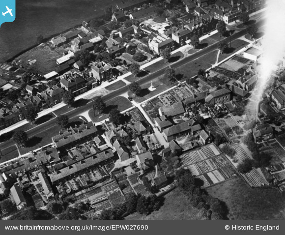
EPW027690 ENGLAND (1929). The war memorial, Tenterden, 1929. This image has been produced from a print affected by flare.
© Copyright OpenStreetMap contributors and licensed by the OpenStreetMap Foundation. 2026. Cartography is licensed as CC BY-SA.
Nearby Images (3)
EPW027690

EPW027689

EPW027691

Details
| Title | [EPW027690] The war memorial, Tenterden, 1929. This image has been produced from a print affected by flare. |
| Reference | EPW027690 |
| Date | 23-June-1929 |
| Link | |
| Place name | TENTERDEN |
| Parish | TENTERDEN |
| District | |
| Country | ENGLAND |
| Easting / Northing | 588161, 133171 |
| Longitude / Latitude | 0.68581875904415, 51.066453437139 |
| National Grid Reference | TQ882332 |
Pins
Be the first to add a comment to this image!