
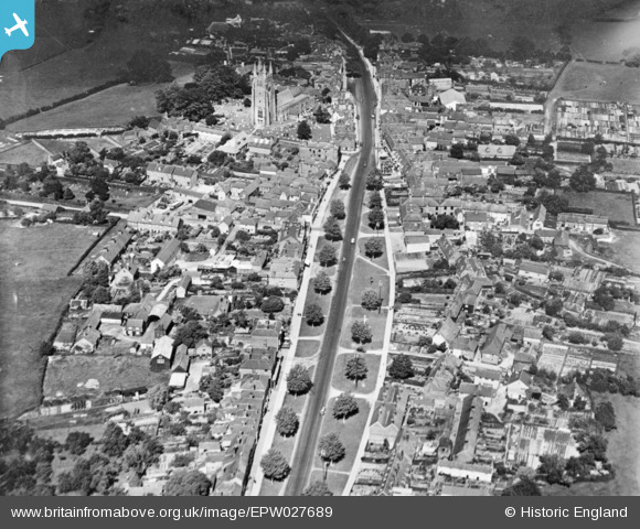
EPW027689 ENGLAND (1929). The High Street, Tenterden, 1929. This image has been produced from a copy-negative.
© Copyright OpenStreetMap contributors and licensed by the OpenStreetMap Foundation. 2026. Cartography is licensed as CC BY-SA.
Nearby Images (4)
EPW027689

EPW027691

EPW027690

EPW027693

Details
| Title | [EPW027689] The High Street, Tenterden, 1929. This image has been produced from a copy-negative. |
| Reference | EPW027689 |
| Date | 23-June-1929 |
| Link | |
| Place name | TENTERDEN |
| Parish | TENTERDEN |
| District | |
| Country | ENGLAND |
| Easting / Northing | 588227, 133249 |
| Longitude / Latitude | 0.68680033249535, 51.067132493717 |
| National Grid Reference | TQ882332 |
Pins
Be the first to add a comment to this image!