
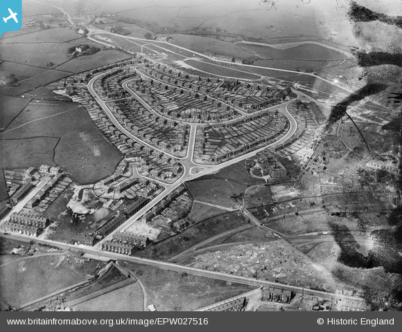
EPW027516 ENGLAND (1929). Gale Street and environs, Rochdale, 1929
© Copyright OpenStreetMap contributors and licensed by the OpenStreetMap Foundation. 2026. Cartography is licensed as CC BY-SA.
Nearby Images (3)
EPW027516

EPW027519

EPW027514

Details
| Title | [EPW027516] Gale Street and environs, Rochdale, 1929 |
| Reference | EPW027516 |
| Date | 11-June-1929 |
| Link | |
| Place name | ROCHDALE |
| Parish | |
| District | |
| Country | ENGLAND |
| Easting / Northing | 389678, 415144 |
| Longitude / Latitude | -2.1561121291703, 53.632485120991 |
| National Grid Reference | SD897151 |
Pins

Pete |
Monday 25th of November 2024 10:31:40 PM | |
|
Pete |
Monday 25th of November 2024 10:28:42 PM | |
|
Pete |
Monday 25th of November 2024 10:27:47 PM | |
|
Pete |
Monday 25th of November 2024 10:27:11 PM | |
|
David |
Wednesday 30th of April 2014 09:56:11 AM | |
|
David |
Wednesday 30th of April 2014 09:55:28 AM | |
|
David |
Wednesday 30th of April 2014 09:55:01 AM | |
|
David |
Wednesday 30th of April 2014 09:54:38 AM | |
|
David |
Wednesday 30th of April 2014 09:53:48 AM | |
|
David |
Wednesday 30th of April 2014 09:53:27 AM | |
|
David |
Wednesday 30th of April 2014 09:52:38 AM | |

Class31 |
Wednesday 6th of February 2013 05:20:18 PM | |
|
Class31 |
Wednesday 6th of February 2013 05:19:02 PM | |
|
Class31 |
Wednesday 6th of February 2013 05:17:22 PM | |
|
Class31 |
Wednesday 6th of February 2013 05:14:52 PM |