
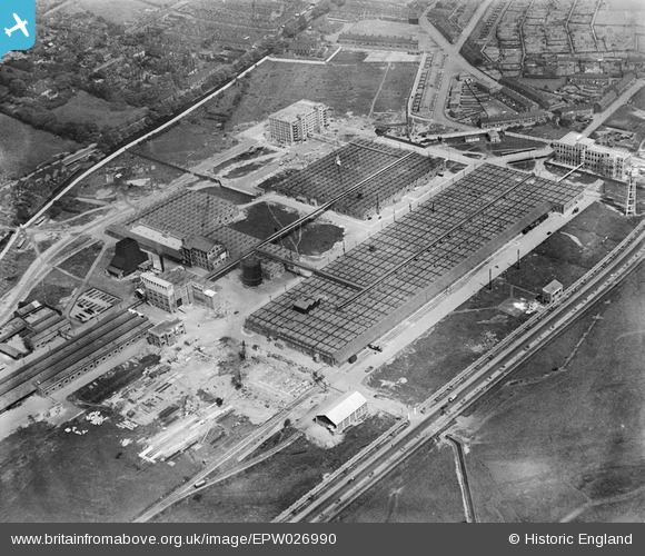
EPW026990 ENGLAND (1929). The Michelin Tyre Manufactory, Boothen, 1929
© Copyright OpenStreetMap contributors and licensed by the OpenStreetMap Foundation. 2026. Cartography is licensed as CC BY-SA.
Nearby Images (42)
EPW026990

EPW026991

EPW019994

EPW041807

EAW035048

EPW019995

EAW036108

EAW036110

EPW026998

EPW019998

EPW019991

EAW036112

EAW035050

EAW036107

EAW035049

EPW026994

EAW036109

EAW035042

EPW019990

EPW019993

EPW026997

EPW019989

EAW036106

EAW036111

EAW035041

EAW035047

EPW026996

EPW019996

EPW041808

EPW026993

EAW035045

EAW035046

EAW035044

EPW019988

EPW019992

EPW026999

EPW026995

EPW026992

EPW019997

EAW035043

EAW036105

EAW036113

Details
| Title | [EPW026990] The Michelin Tyre Manufactory, Boothen, 1929 |
| Reference | EPW026990 |
| Date | May-1929 |
| Link | |
| Place name | BOOTHEN |
| Parish | |
| District | |
| Country | ENGLAND |
| Easting / Northing | 387314, 343770 |
| Longitude / Latitude | -2.1890100192656, 52.990802559311 |
| National Grid Reference | SJ873438 |
Pins

GB |
Saturday 16th of September 2023 10:11:23 AM | |
|
GB |
Saturday 16th of September 2023 10:10:55 AM | |
|
GB |
Saturday 16th of September 2023 10:08:20 AM | |
|
Niblett |
Friday 1st of August 2014 04:29:34 PM |