
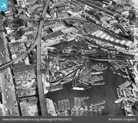
EPW026871 ENGLAND (1929). Regent's Canal Dock, Limehouse, 1929
© Copyright OpenStreetMap contributors and licensed by the OpenStreetMap Foundation. 2026. Cartography is licensed as CC BY-SA.
Nearby Images (11)
EPW026871

EPW021383

EPW026875

EAW022340

EPW026873

EPW021381

EPW021385

EPW021386

EPW021384

EPW026874

EPW021380

Details
| Title | [EPW026871] Regent's Canal Dock, Limehouse, 1929 |
| Reference | EPW026871 |
| Date | May-1929 |
| Link | |
| Place name | LIMEHOUSE |
| Parish | |
| District | |
| Country | ENGLAND |
| Easting / Northing | 536440, 181003 |
| Longitude / Latitude | -0.033618896771545, 51.510975959079 |
| National Grid Reference | TQ364810 |
Pins

Dave Smith |
Thursday 25th of February 2016 05:22:18 PM | |
|
moses72 |
Tuesday 4th of February 2014 05:19:30 PM | |
|
moses72 |
Thursday 20th of June 2013 02:19:12 PM | |

Class31 |
Wednesday 5th of December 2012 10:34:40 PM | |
|
Class31 |
Wednesday 5th of December 2012 10:33:27 PM | |
|
Class31 |
Wednesday 5th of December 2012 10:30:31 PM | |
|
Class31 |
Wednesday 5th of December 2012 10:28:39 PM | |
|
Class31 |
Wednesday 5th of December 2012 10:28:10 PM | |
|
Class31 |
Wednesday 5th of December 2012 10:26:52 PM |