
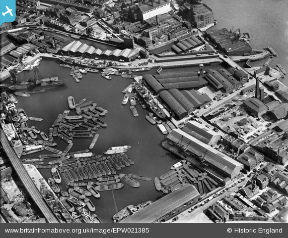
EPW021385 ENGLAND (1928). Regent's Canal Dock, Limehouse, 1928
© Copyright OpenStreetMap contributors and licensed by the OpenStreetMap Foundation. 2026. Cartography is licensed as CC BY-SA.
Nearby Images (14)
EPW021385

EPW021381

EPW021386

EPW021384

EPW026875

EPW021380

EPW026874

EPW026873

EPW021383

EAW022340

EPW026871

EAW022341

EPW026872

EPW026869

Details
| Title | [EPW021385] Regent's Canal Dock, Limehouse, 1928 |
| Reference | EPW021385 |
| Date | 30-May-1928 |
| Link | |
| Place name | LIMEHOUSE |
| Parish | |
| District | |
| Country | ENGLAND |
| Easting / Northing | 536310, 180933 |
| Longitude / Latitude | -0.0355183468993, 51.510378237555 |
| National Grid Reference | TQ363809 |
Pins

User Comment Contributions
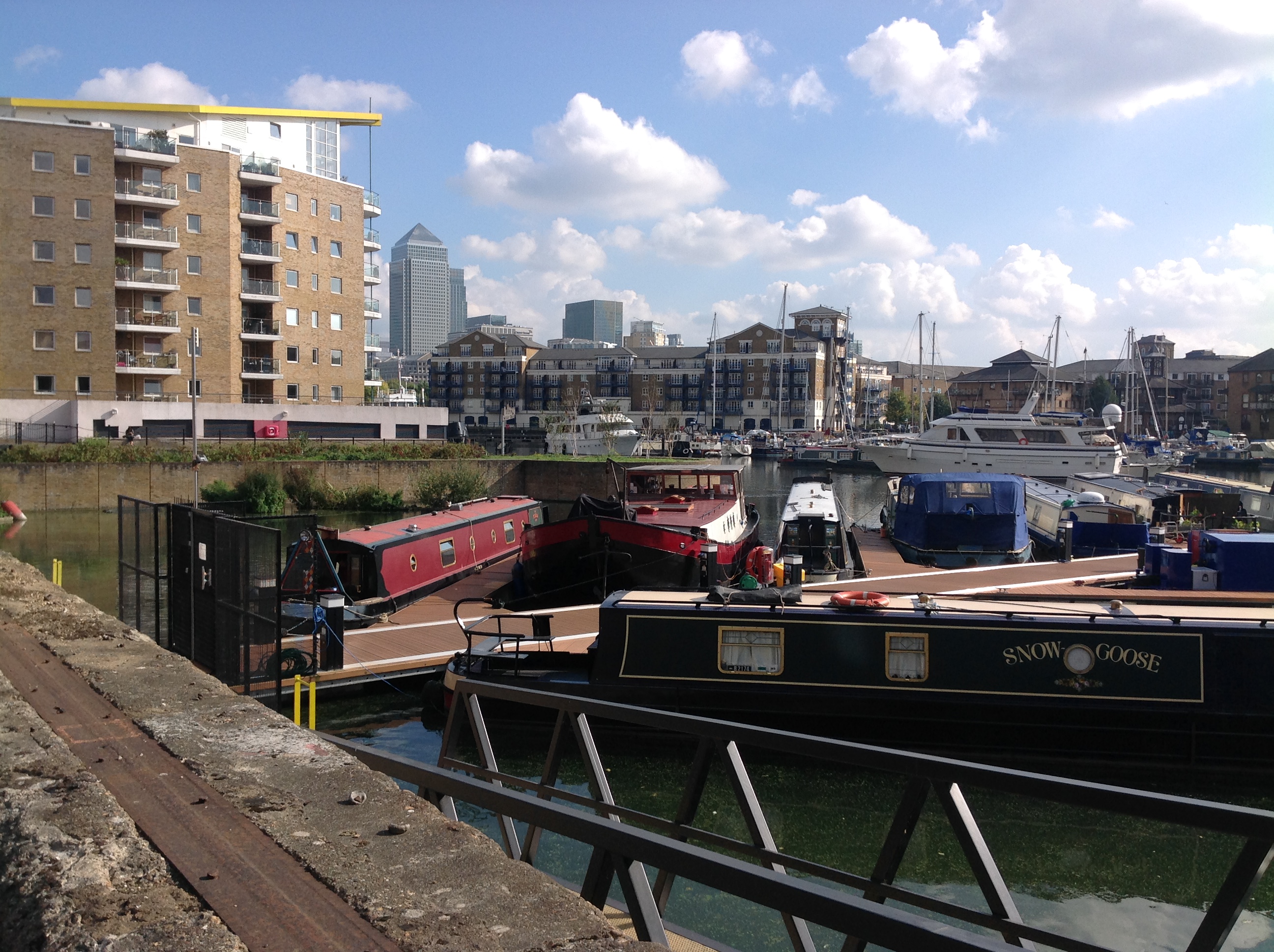
Limehouse Basin, 30/09/2014 |

Class31 |
Tuesday 1st of September 2015 08:23:16 AM |