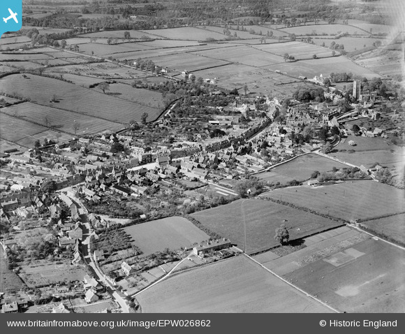
EPW026862 ENGLAND (1929). The town, Chipping Campden, from the south, 1929
© Copyright OpenStreetMap contributors and licensed by the OpenStreetMap Foundation. 2025. Cartography is licensed as CC BY-SA.
Details
| Title | [EPW026862] The town, Chipping Campden, from the south, 1929 |
| Reference | EPW026862 |
| Date | May-1929 |
| Link | |
| Place name | CHIPPING CAMPDEN |
| Parish | CHIPPING CAMPDEN |
| District | |
| Country | ENGLAND |
| Easting / Northing | 415093, 238845 |
| Longitude / Latitude | -1.779893739515, 52.047371975983 |
| National Grid Reference | SP151388 |


![[EPW026862] The town, Chipping Campden, from the south, 1929](http://britainfromabove.org.uk/sites/all/libraries/aerofilms-images/public/100x100/EPW/026/EPW026862.jpg)
![[EPW026876] The town centre, Chipping Campden, 1929](http://britainfromabove.org.uk/sites/all/libraries/aerofilms-images/public/100x100/EPW/026/EPW026876.jpg)
![[EPW026865] St Mary's RC Church and the High Street, Chipping Campden, 1929](http://britainfromabove.org.uk/sites/all/libraries/aerofilms-images/public/100x100/EPW/026/EPW026865.jpg)
![[EAW001659] The Market Place and environs, Chipping Campden, 1946](http://britainfromabove.org.uk/sites/all/libraries/aerofilms-images/public/100x100/EAW/001/EAW001659.jpg)
