
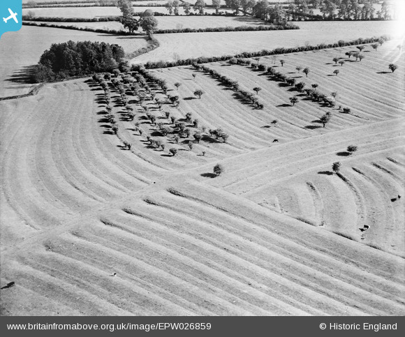
EPW026859 ENGLAND (1929). Ridge and Furrow in the fields around Broad Lessor Coppice, Crimscote, 1929
© Copyright OpenStreetMap contributors and licensed by the OpenStreetMap Foundation. 2026. Cartography is licensed as CC BY-SA.
Nearby Images (6)
EPW026859

EPW026853

EPW026858

EPW026854

EPW026855

EPW026856

Details
| Title | [EPW026859] Ridge and Furrow in the fields around Broad Lessor Coppice, Crimscote, 1929 |
| Reference | EPW026859 |
| Date | May-1929 |
| Link | |
| Place name | CRIMSCOTE |
| Parish | WHITCHURCH |
| District | |
| Country | ENGLAND |
| Easting / Northing | 423013, 246468 |
| Longitude / Latitude | -1.6638810374712, 52.115641570892 |
| National Grid Reference | SP230465 |
Pins
Be the first to add a comment to this image!