
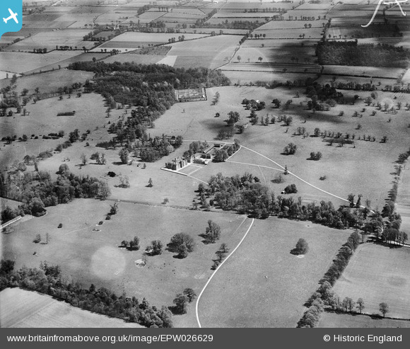
EPW026629 ENGLAND (1929). Belhus Park, Aveley, from the south-west, 1929
© Copyright OpenStreetMap contributors and licensed by the OpenStreetMap Foundation. 2026. Cartography is licensed as CC BY-SA.
Nearby Images (5)
EPW026629

EPW026365

EPW026364

EPW026345

EPW026631

Details
| Title | [EPW026629] Belhus Park, Aveley, from the south-west, 1929 |
| Reference | EPW026629 |
| Date | May-1929 |
| Link | |
| Place name | AVELEY |
| Parish | |
| District | |
| Country | ENGLAND |
| Easting / Northing | 556826, 181043 |
| Longitude / Latitude | 0.25997321844229, 51.506044581653 |
| National Grid Reference | TQ568810 |
Pins

gio |
Sunday 21st of July 2013 09:35:28 PM |