
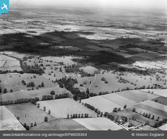
EPW026364 ENGLAND (1929). Belhus Deer Park and surrounding countryside, Belhus Park, from the south, 1929
© Copyright OpenStreetMap contributors and licensed by the OpenStreetMap Foundation. 2026. Cartography is licensed as CC BY-SA.
Nearby Images (5)
EPW026364

EPW026631

EPW026345

EPW026365

EPW026629

Details
| Title | [EPW026364] Belhus Deer Park and surrounding countryside, Belhus Park, from the south, 1929 |
| Reference | EPW026364 |
| Date | April-1929 |
| Link | |
| Place name | BELHUS PARK |
| Parish | |
| District | |
| Country | ENGLAND |
| Easting / Northing | 557021, 180921 |
| Longitude / Latitude | 0.26272662601988, 51.504894198727 |
| National Grid Reference | TQ570809 |
Pins
Be the first to add a comment to this image!