
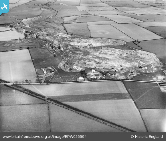
EPW026594 ENGLAND (1929). Tuthill Quarry, Haswell, 1929
© Copyright OpenStreetMap contributors and licensed by the OpenStreetMap Foundation. 2026. Cartography is licensed as CC BY-SA.
Nearby Images (10)
EPW026594

EPW026596

EPW026604

EPW026600

EPW026601

EPW026599

EPW026595

EPW026602

EPW026603

EPW026597

Details
| Title | [EPW026594] Tuthill Quarry, Haswell, 1929 |
| Reference | EPW026594 |
| Date | May-1929 |
| Link | |
| Place name | HASWELL |
| Parish | HASWELL |
| District | |
| Country | ENGLAND |
| Easting / Northing | 439035, 542359 |
| Longitude / Latitude | -1.3931137226864, 54.774528995876 |
| National Grid Reference | NZ390424 |

