
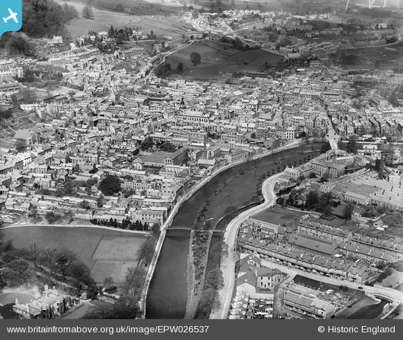
EPW026537 ENGLAND (1929). The town centre, Kendal, from the south-east, 1929
© Copyright OpenStreetMap contributors and licensed by the OpenStreetMap Foundation. 2026. Cartography is licensed as CC BY-SA.
Nearby Images (9)
EPW026537

EPW026540

EAW014500

EPW026541

EPW026538

EPW038829

EPW038828

EAW043385

EAW043384

Details
| Title | [EPW026537] The town centre, Kendal, from the south-east, 1929 |
| Reference | EPW026537 |
| Date | May-1929 |
| Link | |
| Place name | KENDAL |
| Parish | KENDAL |
| District | |
| Country | ENGLAND |
| Easting / Northing | 351702, 492352 |
| Longitude / Latitude | -2.7426789024017, 54.324304032469 |
| National Grid Reference | SD517924 |
Pins

Benny boy |
Sunday 17th of November 2013 11:57:00 PM | |

Maurice |
Tuesday 11th of June 2013 07:36:08 PM | |
|
Maurice |
Tuesday 11th of June 2013 07:35:34 PM | |
|
MB |
Wednesday 12th of September 2012 10:49:18 PM | |
|
MB |
Wednesday 12th of September 2012 10:48:41 PM | |
|
MB |
Wednesday 12th of September 2012 10:47:46 PM | |
|
MB |
Wednesday 12th of September 2012 10:44:50 PM | |
|
MB |
Wednesday 12th of September 2012 10:43:46 PM | |
|
MB |
Wednesday 12th of September 2012 10:43:00 PM | |
|
MB |
Wednesday 12th of September 2012 10:40:54 PM | |
|
MB |
Wednesday 12th of September 2012 10:40:28 PM | |
|
MB |
Wednesday 12th of September 2012 10:39:41 PM | |
|
MB |
Wednesday 12th of September 2012 10:39:03 PM | |
|
JohnA |
Friday 20th of July 2012 10:56:24 AM |