
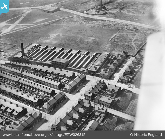
EPW026315 ENGLAND (1929). The Gandy Belt Company Wheatland Works, Seacombe, 1929
© Copyright OpenStreetMap contributors and licensed by the OpenStreetMap Foundation. 2026. Cartography is licensed as CC BY-SA.
Nearby Images (9)
EPW026315

EPW026318

EPW026319

EPW026314

EPW026320

EPW026313

EPW026316

EPW026317

EAW038515

Details
| Title | [EPW026315] The Gandy Belt Company Wheatland Works, Seacombe, 1929 |
| Reference | EPW026315 |
| Date | April-1929 |
| Link | |
| Place name | SEACOMBE |
| Parish | |
| District | |
| Country | ENGLAND |
| Easting / Northing | 331878, 390697 |
| Longitude / Latitude | -3.0248852294682, 53.408424587458 |
| National Grid Reference | SJ319907 |
Pins
Be the first to add a comment to this image!