
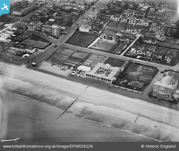
EPW026126 ENGLAND (1929). The Pavilion and Arthur Road, Hythe, 1929
© Copyright OpenStreetMap contributors and licensed by the OpenStreetMap Foundation. 2026. Cartography is licensed as CC BY-SA.
Nearby Images (6)
EPW026126

EPW026128

EPW000150

EPW026124

EAW013671

EPW000153

Details
| Title | [EPW026126] The Pavilion and Arthur Road, Hythe, 1929 |
| Reference | EPW026126 |
| Date | April-1929 |
| Link | |
| Place name | HYTHE |
| Parish | HYTHE |
| District | |
| Country | ENGLAND |
| Easting / Northing | 616299, 134169 |
| Longitude / Latitude | 1.0874749907603, 51.06550428023 |
| National Grid Reference | TR163342 |
Pins
Be the first to add a comment to this image!