
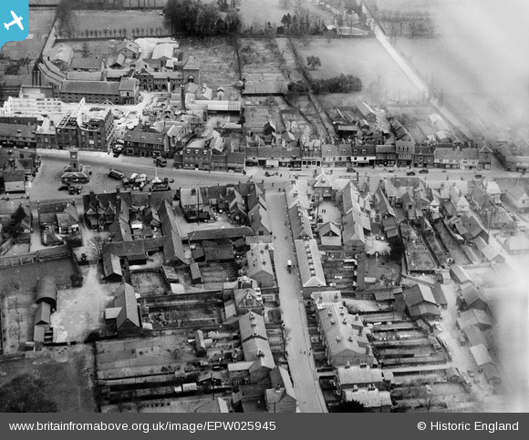
EPW025945 ENGLAND (1929). The Market Place and Lord Street, Hoddesdon, 1929
© Copyright OpenStreetMap contributors and licensed by the OpenStreetMap Foundation. 2026. Cartography is licensed as CC BY-SA.
Nearby Images (8)
EPW025945

EPW013324

EPW025940

EPW025938

EPW025944

EPW025942

EPW025939

EPW013322

Details
| Title | [EPW025945] The Market Place and Lord Street, Hoddesdon, 1929 |
| Reference | EPW025945 |
| Date | 3-April-1929 |
| Link | |
| Place name | HODDESDON |
| Parish | |
| District | |
| Country | ENGLAND |
| Easting / Northing | 537287, 208802 |
| Longitude / Latitude | -0.010514699327668, 51.760597666221 |
| National Grid Reference | TL373088 |
Pins

Stu Giles |
Tuesday 3rd of July 2018 03:39:01 PM | |
|
Max B |
Wednesday 29th of June 2016 03:39:42 PM | |
|
SteveAUS |
Friday 31st of August 2012 05:44:20 AM |
User Comment Contributions
Brewery being demolished I believe. Hence Brewery Road |
David |
Tuesday 5th of November 2013 09:51:16 PM |