
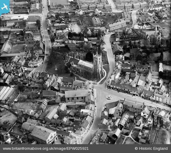
EPW025921 ENGLAND (1929). St Andrew's Church and environs, Halstead, 1929
© Copyright OpenStreetMap contributors and licensed by the OpenStreetMap Foundation. 2026. Cartography is licensed as CC BY-SA.
Nearby Images (7)
EPW025921

EPW025920

EAW029719

EPW025918

EAW029718

EPW025923

EAW029717

Details
| Title | [EPW025921] St Andrew's Church and environs, Halstead, 1929 |
| Reference | EPW025921 |
| Date | 3-April-1929 |
| Link | |
| Place name | HALSTEAD |
| Parish | HALSTEAD |
| District | |
| Country | ENGLAND |
| Easting / Northing | 581512, 230695 |
| Longitude / Latitude | 0.64122229749813, 51.944664101394 |
| National Grid Reference | TL815307 |
Pins

Jeremy |
Wednesday 28th of August 2013 04:49:36 PM | |
|
Jeremy |
Wednesday 28th of August 2013 04:47:47 PM | |
|
Jeremy |
Wednesday 28th of August 2013 04:47:25 PM | |
|
Jeremy |
Wednesday 28th of August 2013 04:46:55 PM | |
|
Jeremy |
Wednesday 28th of August 2013 04:46:21 PM |