
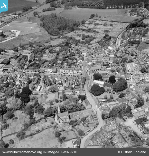
EAW029718 ENGLAND (1950). St Andrew's Church and the town, Halstead, 1950
© Copyright OpenStreetMap contributors and licensed by the OpenStreetMap Foundation. 2026. Cartography is licensed as CC BY-SA.
Nearby Images (7)
EAW029718

EPW025918

EPW025921

EPW025920

EAW029719

EPW025923

EAW029717

Details
| Title | [EAW029718] St Andrew's Church and the town, Halstead, 1950 |
| Reference | EAW029718 |
| Date | 30-May-1950 |
| Link | |
| Place name | HALSTEAD |
| Parish | HALSTEAD |
| District | |
| Country | ENGLAND |
| Easting / Northing | 581444, 230696 |
| Longitude / Latitude | 0.64023447717407, 51.944695266073 |
| National Grid Reference | TL814307 |
Pins

Stephen Mirrington |
Sunday 21st of September 2025 05:28:35 PM | |
|
Ian Lock |
Friday 5th of February 2016 10:48:05 AM | |
|
Steve Willia895 |
Wednesday 3rd of December 2014 03:02:14 PM | |
|
Steve Willia895 |
Wednesday 3rd of December 2014 02:19:09 PM |