
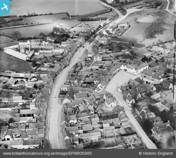
EPW025905 ENGLAND (1929). The town centre, Lavenham, 1929
© Copyright OpenStreetMap contributors and licensed by the OpenStreetMap Foundation. 2026. Cartography is licensed as CC BY-SA.
Nearby Images (10)
EPW025905

EPW025902

EAW033348

EPW025904

EPW025906

EAW033351

EAW033347

EAW033352

EAW033349

EAW033346

Details
| Title | [EPW025905] The town centre, Lavenham, 1929 |
| Reference | EPW025905 |
| Date | 3-April-1929 |
| Link | |
| Place name | LAVENHAM |
| Parish | LAVENHAM |
| District | |
| Country | ENGLAND |
| Easting / Northing | 591560, 249353 |
| Longitude / Latitude | 0.79769534528025, 52.108862996147 |
| National Grid Reference | TL916494 |
Pins

ArtyLavenham |
Thursday 2nd of January 2020 06:53:50 PM |