
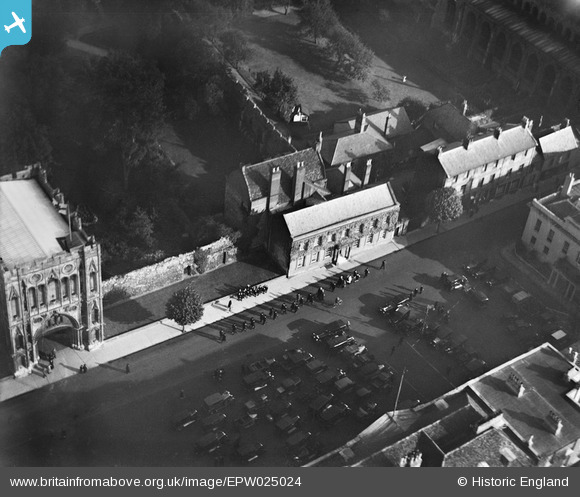
EPW025024 ENGLAND (1928). The Abbey Gate and Angel Hill, Bury St Edmunds, 1928
© Copyright OpenStreetMap contributors and licensed by the OpenStreetMap Foundation. 2026. Cartography is licensed as CC BY-SA.
Nearby Images (15)
EPW025024

EPW001753

EAW024397

EPW025022

EAW024395

EAW029742

EPW025020

EAW024398

EAW024396

EPW025021

EPW025023

EAW029744

EPW001752

EPW001749

EPW001773

Details
| Title | [EPW025024] The Abbey Gate and Angel Hill, Bury St Edmunds, 1928 |
| Reference | EPW025024 |
| Date | 9-October-1928 |
| Link | |
| Place name | BURY ST EDMUNDS |
| Parish | BURY ST. EDMUNDS |
| District | |
| Country | ENGLAND |
| Easting / Northing | 585539, 264183 |
| Longitude / Latitude | 0.7179805428969, 52.244109485924 |
| National Grid Reference | TL855642 |
Pins
Be the first to add a comment to this image!
User Comment Contributions

This photo was taken before the erection of the signpost nicknamed the ‘Pillar of Salt’ which stands on Angel Hill, roughly in the bottom L-hand corner of this picture. The Grade II listed road sign [pictured] was designed by Basil Oliver, architect to St Edmundsbury Borough Council, and erected in 1935. It is considered to be the first internally illuminated traffic sign in the UK. It was granted special approval because it did not conform to regulations. |

MorrisDancer |
Thursday 19th of December 2013 06:17:00 PM |