
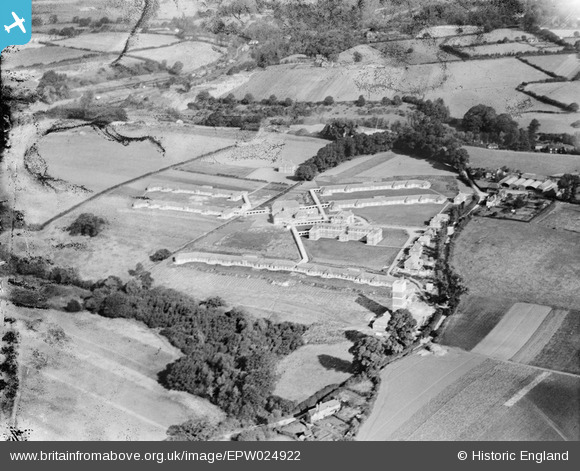
EPW024922 ENGLAND (1928). The Surrey County Sanatorium, Tuesley, 1928. This image has been produced from a damaged negative.
© Copyright OpenStreetMap contributors and licensed by the OpenStreetMap Foundation. 2026. Cartography is licensed as CC BY-SA.
Nearby Images (15)
EPW024922

EPW023437

EPW024589

EPW024594

EPW023435

EPW024590

EPW024588

EPW024592

EPW023440

EPW024593

EPW024923

EPW024587

EPW024921

EPW024930

EPW023436

Details
| Title | [EPW024922] The Surrey County Sanatorium, Tuesley, 1928. This image has been produced from a damaged negative. |
| Reference | EPW024922 |
| Date | 3-October-1928 |
| Link | |
| Place name | TUESLEY |
| Parish | BUSBRIDGE |
| District | |
| Country | ENGLAND |
| Easting / Northing | 496143, 141810 |
| Longitude / Latitude | -0.6247483720402, 51.166922375886 |
| National Grid Reference | SU961418 |
Pins

Dan Gregory |
Tuesday 3rd of June 2014 06:12:43 PM | |
|
Dan Gregory |
Tuesday 3rd of June 2014 06:12:00 PM | |
|
Dan Gregory |
Tuesday 3rd of June 2014 06:11:29 PM | |
|
Dan Gregory |
Tuesday 3rd of June 2014 06:10:56 PM | |
|
Dan Gregory |
Tuesday 3rd of June 2014 06:10:26 PM | |
|
Dan Gregory |
Tuesday 3rd of June 2014 06:09:15 PM | |
|
Dan Gregory |
Tuesday 3rd of June 2014 06:08:35 PM | |
|
Dan Gregory |
Tuesday 3rd of June 2014 06:08:07 PM | |
|
Dan Gregory |
Tuesday 3rd of June 2014 06:06:23 PM |