
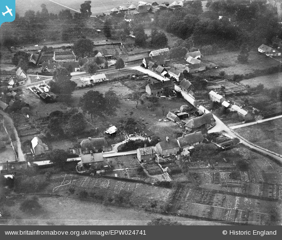
EPW024741 ENGLAND (1928). Martin's Lane, Dorchester, 1928
© Copyright OpenStreetMap contributors and licensed by the OpenStreetMap Foundation. 2025. Cartography is licensed as CC BY-SA.
Nearby Images (4)
EPW024741

EPW024740

EAW046253

EAW046252

Details
| Title | [EPW024741] Martin's Lane, Dorchester, 1928 |
| Reference | EPW024741 |
| Date | September-1928 |
| Link | |
| Place name | DORCHESTER |
| Parish | DORCHESTER |
| District | |
| Country | ENGLAND |
| Easting / Northing | 457818, 194493 |
| Longitude / Latitude | -1.1642846040147, 51.645791998575 |
| National Grid Reference | SU578945 |
Pins
Be the first to add a comment to this image!