
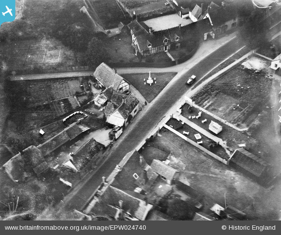
EPW024740 ENGLAND (1928). The War Memorial, Dorchester, 1928
© Copyright OpenStreetMap contributors and licensed by the OpenStreetMap Foundation. 2025. Cartography is licensed as CC BY-SA.
Nearby Images (8)
EPW024740

EPW024741

EAW033310

EPW024744

EPW024739

EAW046253

EAW046252

EPW024742

Details
| Title | [EPW024740] The War Memorial, Dorchester, 1928 |
| Reference | EPW024740 |
| Date | September-1928 |
| Link | |
| Place name | DORCHESTER |
| Parish | DORCHESTER |
| District | |
| Country | ENGLAND |
| Easting / Northing | 457727, 194434 |
| Longitude / Latitude | -1.1656095282726, 51.645270862299 |
| National Grid Reference | SU577944 |
Pins

melgibbs |
Tuesday 7th of January 2014 08:27:52 PM | |
|
melgibbs |
Tuesday 7th of January 2014 08:25:34 PM | |
|
melgibbs |
Tuesday 7th of January 2014 08:25:11 PM |