
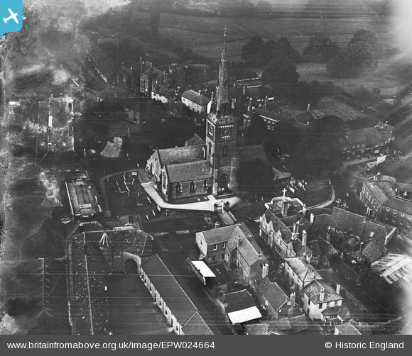
EPW024664 ENGLAND (1928). St Mary's Church, Petworth, 1928
© Copyright OpenStreetMap contributors and licensed by the OpenStreetMap Foundation. 2026. Cartography is licensed as CC BY-SA.
Nearby Images (5)
EPW024664

EPW024660

EPW024662

EPW024665

EPW024667

Details
| Title | [EPW024664] St Mary's Church, Petworth, 1928 |
| Reference | EPW024664 |
| Date | September-1928 |
| Link | |
| Place name | PETWORTH |
| Parish | PETWORTH |
| District | |
| Country | ENGLAND |
| Easting / Northing | 497673, 121858 |
| Longitude / Latitude | -0.60826251565882, 50.987284791815 |
| National Grid Reference | SU977219 |
Pins

David960 |
Monday 26th of January 2015 07:04:56 PM | |
|
David960 |
Monday 26th of January 2015 07:04:01 PM | |

Alan McFaden |
Monday 25th of November 2013 06:17:09 PM |

User Comment Contributions

Petworth House |
Alan McFaden |
Wednesday 10th of September 2014 10:14:59 AM |

Petworth |
Alan McFaden |
Wednesday 10th of September 2014 10:14:20 AM |

Petworth |
Alan McFaden |
Wednesday 10th of September 2014 10:14:03 AM |

Petworth |
Alan McFaden |
Wednesday 10th of September 2014 10:13:45 AM |

Saint Mary the Virgin Church |
Alan McFaden |
Wednesday 10th of September 2014 10:13:27 AM |