
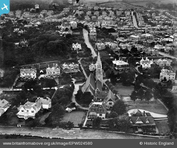
EPW024580 ENGLAND (1928). St Saviour's Church and environs, Shanklin, 1928
© Copyright OpenStreetMap contributors and licensed by the OpenStreetMap Foundation. 2026. Cartography is licensed as CC BY-SA.
Nearby Images (19)
EPW024580

EPW022922

EAW015235

EAW015239

EAW015240

EPW024584

EAW038586

EPW022920

EAW015234

EAW015238

EAW015236

EAW015237

EPW022915

EPW024582

EPW024578

EPW000802

EPW016863

EAW022211

EPW039647

Details
| Title | [EPW024580] St Saviour's Church and environs, Shanklin, 1928 |
| Reference | EPW024580 |
| Date | September-1928 |
| Link | |
| Place name | SHANKLIN |
| Parish | SHANKLIN |
| District | |
| Country | ENGLAND |
| Easting / Northing | 458389, 81313 |
| Longitude / Latitude | -1.1743863813386, 50.628005863687 |
| National Grid Reference | SZ584813 |
Pins
Be the first to add a comment to this image!