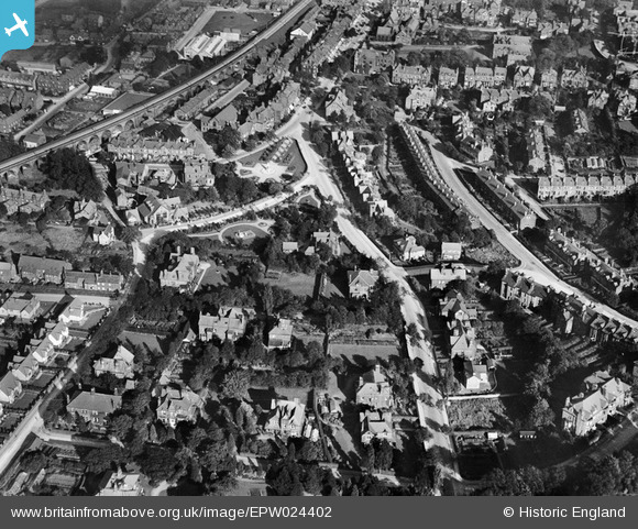
EPW024402 ENGLAND (1928). Grove Road and the Memorial Ground, Ilkley, 1928
© Copyright OpenStreetMap contributors and licensed by the OpenStreetMap Foundation. 2025. Cartography is licensed as CC BY-SA.
Details
| Title | [EPW024402] Grove Road and the Memorial Ground, Ilkley, 1928 |
| Reference | EPW024402 |
| Date | September-1928 |
| Link | |
| Place name | ILKLEY |
| Parish | ILKLEY |
| District | |
| Country | ENGLAND |
| Easting / Northing | 411228, 447579 |
| Longitude / Latitude | -1.8290043174555, 53.92402478068 |
| National Grid Reference | SE112476 |
Pins

John W |
Monday 1st of August 2016 06:16:51 PM | |

John W |
Monday 1st of August 2016 06:13:22 PM | |

Jenny |
Tuesday 27th of January 2015 04:56:03 PM | |

Jaysholme |
Saturday 26th of April 2014 08:53:30 AM |


![[EPW024402] Grove Road and the Memorial Ground, Ilkley, 1928](http://britainfromabove.org.uk/sites/all/libraries/aerofilms-images/public/100x100/EPW/024/EPW024402.jpg)
![[EPW024537] Spence's Garden and environs, Ilkley, 1928](http://britainfromabove.org.uk/sites/all/libraries/aerofilms-images/public/100x100/EPW/024/EPW024537.jpg)
![[EPW024361] The Memorial Ground and Spence's Garden, Ilkley, 1928](http://britainfromabove.org.uk/sites/all/libraries/aerofilms-images/public/100x100/EPW/024/EPW024361.jpg)