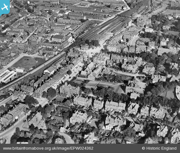
EPW024362 ENGLAND (1928). Ilkley Station and The Grove, Ilkley, 1928
© Copyright OpenStreetMap contributors and licensed by the OpenStreetMap Foundation. 2025. Cartography is licensed as CC BY-SA.
Nearby Images (8)
Details
| Title | [EPW024362] Ilkley Station and The Grove, Ilkley, 1928 |
| Reference | EPW024362 |
| Date | October-1928 |
| Link | |
| Place name | ILKLEY |
| Parish | ILKLEY |
| District | |
| Country | ENGLAND |
| Easting / Northing | 411595, 447587 |
| Longitude / Latitude | -1.8234148536501, 53.924088603513 |
| National Grid Reference | SE116476 |
Pins

gBr |
Friday 22nd of January 2016 07:43:03 PM | |

dannyboy |
Monday 6th of October 2014 11:29:54 PM | |

dannyboy |
Sunday 25th of August 2013 05:27:22 AM | |

dannyboy |
Sunday 25th of August 2013 05:26:22 AM | |
Still is though with shortened hours for opening to Public. |

Freerangeegs |
Wednesday 11th of December 2013 07:09:26 PM |
Used to be 24/7 when I was stationed there - that is called progress! |

dannyboy |
Monday 6th of October 2014 11:28:47 PM |


![[EPW024362] Ilkley Station and The Grove, Ilkley, 1928](http://britainfromabove.org.uk/sites/all/libraries/aerofilms-images/public/100x100/EPW/024/EPW024362.jpg)
![[EPW024364] Ilkley Station and The Grove, Ilkley, 1928](http://britainfromabove.org.uk/sites/all/libraries/aerofilms-images/public/100x100/EPW/024/EPW024364.jpg)
![[EPW024365] Ilkley Station and The Grove, Ilkley, 1928](http://britainfromabove.org.uk/sites/all/libraries/aerofilms-images/public/100x100/EPW/024/EPW024365.jpg)
![[EPW024363] Brook Street Rail Bridge and the station, Ilkley, 1928](http://britainfromabove.org.uk/sites/all/libraries/aerofilms-images/public/100x100/EPW/024/EPW024363.jpg)
![[EPW024401] All Saints Church and the town centre, Ilkley, 1928](http://britainfromabove.org.uk/sites/all/libraries/aerofilms-images/public/100x100/EPW/024/EPW024401.jpg)
![[EPW024550] The railway station and environs, Ilkley, 1928](http://britainfromabove.org.uk/sites/all/libraries/aerofilms-images/public/100x100/EPW/024/EPW024550.jpg)
![[EPW024361] The Memorial Ground and Spence's Garden, Ilkley, 1928](http://britainfromabove.org.uk/sites/all/libraries/aerofilms-images/public/100x100/EPW/024/EPW024361.jpg)
![[EPW024536] All Saints' Church and environs, Ilkley, 1928](http://britainfromabove.org.uk/sites/all/libraries/aerofilms-images/public/100x100/EPW/024/EPW024536.jpg)