
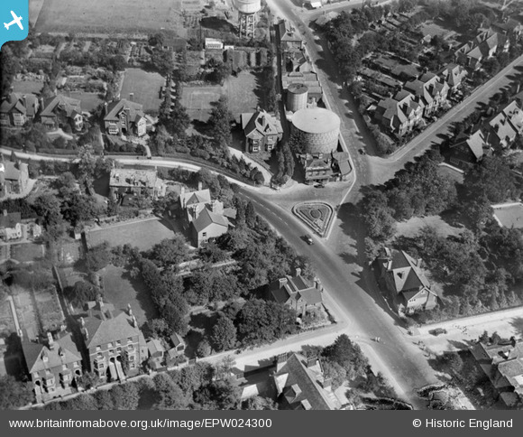
EPW024300 ENGLAND (1928). The Cricketers Public House and environs, St Albans, 1928
© Copyright OpenStreetMap contributors and licensed by the OpenStreetMap Foundation. 2026. Cartography is licensed as CC BY-SA.
Nearby Images (8)
EPW024300

EAW003451

EAW003452

EAW000661

EAW003450

EAW003449

EAW015578

EPW001252

Details
| Title | [EPW024300] The Cricketers Public House and environs, St Albans, 1928 |
| Reference | EPW024300 |
| Date | September-1928 |
| Link | |
| Place name | ST ALBANS |
| Parish | |
| District | |
| Country | ENGLAND |
| Easting / Northing | 515118, 207903 |
| Longitude / Latitude | -0.33191211751072, 51.757514477629 |
| National Grid Reference | TL151079 |
Pins
Be the first to add a comment to this image!