
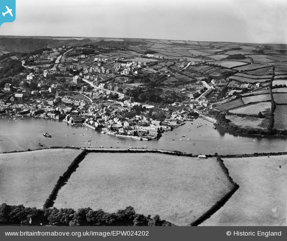
EPW024202 ENGLAND (1928). The town and surrounding countryside, Salcombe, from the north-east, 1928
© Copyright OpenStreetMap contributors and licensed by the OpenStreetMap Foundation. 2025. Cartography is licensed as CC BY-SA.
Nearby Images (2)
EPW024202

EPW024191

Details
| Title | [EPW024202] The town and surrounding countryside, Salcombe, from the north-east, 1928 |
| Reference | EPW024202 |
| Date | September-1928 |
| Link | |
| Place name | SALCOMBE |
| Parish | SALCOMBE |
| District | |
| Country | ENGLAND |
| Easting / Northing | 274405, 39462 |
| Longitude / Latitude | -3.7615235607997, 50.241165760822 |
| National Grid Reference | SX744395 |
Pins

redmist |
Sunday 24th of July 2022 10:39:20 PM | |
|
Judith Murch |
Wednesday 17th of April 2019 01:46:49 PM | |
|
MandyLowe |
Tuesday 16th of April 2019 07:56:46 PM | |

Class31 |
Tuesday 7th of August 2012 10:17:04 AM | |
|
Class31 |
Tuesday 7th of August 2012 10:16:41 AM | |
|
Class31 |
Tuesday 7th of August 2012 10:15:59 AM |