
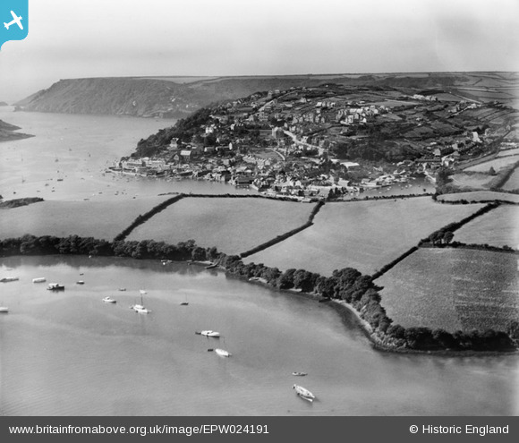
EPW024191 ENGLAND (1928). The town and harbour, Salcombe, from the north-east, 1928
© Copyright OpenStreetMap contributors and licensed by the OpenStreetMap Foundation. 2025. Cartography is licensed as CC BY-SA.
Nearby Images (2)
EPW024191

EPW024202

Details
| Title | [EPW024191] The town and harbour, Salcombe, from the north-east, 1928 |
| Reference | EPW024191 |
| Date | September-1928 |
| Link | |
| Place name | SALCOMBE |
| Parish | SALCOMBE |
| District | |
| Country | ENGLAND |
| Easting / Northing | 274486, 39588 |
| Longitude / Latitude | -3.7604298042169, 50.242315736679 |
| National Grid Reference | SX745396 |
Pins
 Judith Murch |
Wednesday 17th of April 2019 01:33:55 PM |