
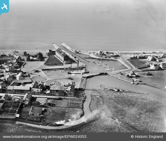
EPW024053 ENGLAND (1928). Bridport Harbour, West Bay, 1928
© Copyright OpenStreetMap contributors and licensed by the OpenStreetMap Foundation. 2026. Cartography is licensed as CC BY-SA.
Nearby Images (10)
EPW024053

EAW047123

EPW024046

EPW013482

EAW050062

EAW047124

EAW047125

EPW024050

EPW024049

EAW050061

Details
| Title | [EPW024053] Bridport Harbour, West Bay, 1928 |
| Reference | EPW024053 |
| Date | September-1928 |
| Link | |
| Place name | WEST BAY |
| Parish | BRIDPORT |
| District | |
| Country | ENGLAND |
| Easting / Northing | 346239, 90435 |
| Longitude / Latitude | -2.761506624042, 50.710485221219 |
| National Grid Reference | SY462904 |
Pins

Alan McFaden |
Saturday 12th of April 2014 10:03:37 AM | |
|
Alan McFaden |
Saturday 12th of April 2014 10:02:29 AM | |

vof |
Saturday 4th of May 2013 01:37:03 AM | |
|
vof |
Saturday 4th of May 2013 01:35:08 AM | |
|
vof |
Saturday 4th of May 2013 01:28:51 AM | |
|
Pat Hawker |
Thursday 11th of April 2013 09:47:55 AM | |

Class31 |
Tuesday 9th of April 2013 04:31:49 PM |


