
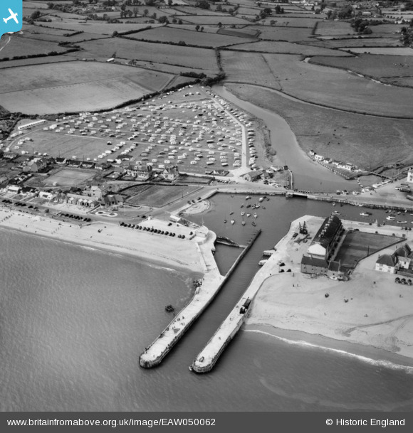
EAW050062 ENGLAND (1953). Bridport Harbour and the Municipal Camping Ground, West Bay, 1953
© Copyright OpenStreetMap contributors and licensed by the OpenStreetMap Foundation. 2026. Cartography is licensed as CC BY-SA.
Nearby Images (10)
EAW050062

EAW047123

EPW024053

EPW024046

EPW013482

EPW024050

EPW024049

EAW047125

EAW047124

EAW050061

Details
| Title | [EAW050062] Bridport Harbour and the Municipal Camping Ground, West Bay, 1953 |
| Reference | EAW050062 |
| Date | 25-June-1953 |
| Link | |
| Place name | WEST BAY |
| Parish | BRIDPORT |
| District | |
| Country | ENGLAND |
| Easting / Northing | 346171, 90459 |
| Longitude / Latitude | -2.7624732316636, 50.710694756717 |
| National Grid Reference | SY462905 |
Pins

vof |
Friday 22nd of August 2014 05:22:06 PM | |

Alan McFaden |
Thursday 5th of June 2014 09:40:46 PM | |
|
Alan McFaden |
Thursday 5th of June 2014 09:39:59 PM |

