
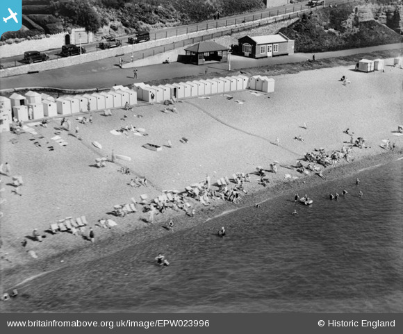
EPW023996 ENGLAND (1928). Beach huts at the bottom of Coastguard Hill, Budleigh Salterton, 1928
© Copyright OpenStreetMap contributors and licensed by the OpenStreetMap Foundation. 2026. Cartography is licensed as CC BY-SA.
Nearby Images (6)
EPW023996

EPW023990

EPW023997

EPW033481

EPW023989

EPW023993

Details
| Title | [EPW023996] Beach huts at the bottom of Coastguard Hill, Budleigh Salterton, 1928 |
| Reference | EPW023996 |
| Date | September-1928 |
| Link | |
| Place name | BUDLEIGH SALTERTON |
| Parish | BUDLEIGH SALTERTON |
| District | |
| Country | ENGLAND |
| Easting / Northing | 306890, 81878 |
| Longitude / Latitude | -3.3165940104175, 50.628573872793 |
| National Grid Reference | SY069819 |
Pins
Allen T |
Monday 15th of September 2014 04:47:41 PM | |
Allen T |
Monday 15th of September 2014 04:46:49 PM | |
Allen T |
Wednesday 17th of July 2013 11:40:51 AM | |
Allen T |
Wednesday 17th of July 2013 11:28:05 AM | |
Fascinating to see these groups on the beach 85 years ago. Overdressed compared to now but the swimsuits are more cut away than I thought. |
Allen T |
Wednesday 17th of July 2013 11:36:38 AM |