
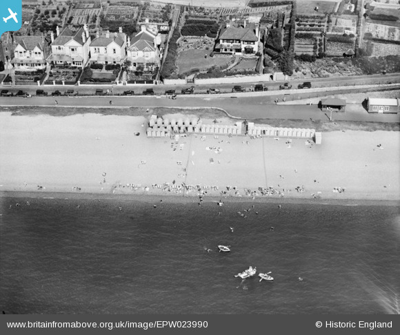
EPW023990 ENGLAND (1928). Beach huts at the bottom of Coastguard Hill, Budleigh Salterton, 1928
© Copyright OpenStreetMap contributors and licensed by the OpenStreetMap Foundation. 2026. Cartography is licensed as CC BY-SA.
Nearby Images (6)
EPW023990

EPW023996

EPW023997

EPW033481

EPW023989

EPW023993

Details
| Title | [EPW023990] Beach huts at the bottom of Coastguard Hill, Budleigh Salterton, 1928 |
| Reference | EPW023990 |
| Date | September-1928 |
| Link | |
| Place name | BUDLEIGH SALTERTON |
| Parish | BUDLEIGH SALTERTON |
| District | |
| Country | ENGLAND |
| Easting / Northing | 306876, 81893 |
| Longitude / Latitude | -3.31679568545, 50.628706508197 |
| National Grid Reference | SY069819 |
Pins
Be the first to add a comment to this image!