
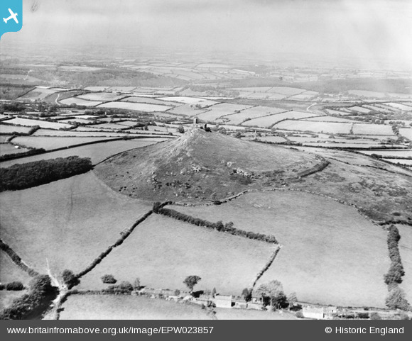
EPW023857 ENGLAND (1928). St Michael's Church, Brent Tor, from the south-east, 1928
© Copyright OpenStreetMap contributors and licensed by the OpenStreetMap Foundation. 2026. Cartography is licensed as CC BY-SA.
Nearby Images (2)
EPW023857

EPW023856

Details
| Title | [EPW023857] St Michael's Church, Brent Tor, from the south-east, 1928 |
| Reference | EPW023857 |
| Date | September-1928 |
| Link | |
| Place name | BRENT TOR |
| Parish | BRENTOR |
| District | |
| Country | ENGLAND |
| Easting / Northing | 247180, 80221 |
| Longitude / Latitude | -4.1597084386684, 50.601087893439 |
| National Grid Reference | SX472802 |
Pins

totoro |
Tuesday 17th of December 2013 07:14:52 PM |
User Comment Contributions
This view is looking approximately due North |
totoro |
Tuesday 17th of December 2013 07:35:49 PM |