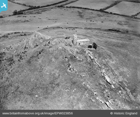
EPW023856 ENGLAND (1928). St Michael's Church, Brent Tor, 1928
© Copyright OpenStreetMap contributors and licensed by the OpenStreetMap Foundation. 2025. Cartography is licensed as CC BY-SA.
Details
| Title | [EPW023856] St Michael's Church, Brent Tor, 1928 |
| Reference | EPW023856 |
| Date | September-1928 |
| Link | |
| Place name | BRENT TOR |
| Parish | BRENTOR |
| District | |
| Country | ENGLAND |
| Easting / Northing | 247057, 80378 |
| Longitude / Latitude | -4.1615100673207, 50.602466700681 |
| National Grid Reference | SX471804 |
Pins

totoro |
Tuesday 17th of December 2013 07:15:11 PM |
User Comment Contributions
This view is looking approximately due North |

totoro |
Tuesday 17th of December 2013 07:35:21 PM |


![[EPW023856] St Michael's Church, Brent Tor, 1928](http://britainfromabove.org.uk/sites/all/libraries/aerofilms-images/public/100x100/EPW/023/EPW023856.jpg)
![[EPW023857] St Michael's Church, Brent Tor, from the south-east, 1928](http://britainfromabove.org.uk/sites/all/libraries/aerofilms-images/public/100x100/EPW/023/EPW023857.jpg)