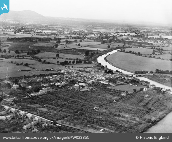
EPW023855 ENGLAND (1928). The town, River Severn and Malvern Hills, Upton-upon-Severn, from the south-east, 1928
© Copyright OpenStreetMap contributors and licensed by the OpenStreetMap Foundation. 2025. Cartography is licensed as CC BY-SA.
Details
| Title | [EPW023855] The town, River Severn and Malvern Hills, Upton-upon-Severn, from the south-east, 1928 |
| Reference | EPW023855 |
| Date | October-1928 |
| Link | |
| Place name | UPTON-UPON-SEVERN |
| Parish | UPTON-UPON-SEVERN |
| District | |
| Country | ENGLAND |
| Easting / Northing | 385278, 240424 |
| Longitude / Latitude | -2.2147639512902, 52.061579683545 |
| National Grid Reference | SO853404 |
Pins

John W |
Saturday 23rd of November 2019 04:39:58 PM | |

John G. |
Tuesday 17th of February 2015 05:10:18 PM | |

Stephen Peters |
Saturday 25th of August 2012 09:56:14 AM | |

BobE |
Thursday 28th of June 2012 12:09:36 PM | |

BobE |
Thursday 28th of June 2012 12:02:12 PM | |

BobE |
Wednesday 27th of June 2012 10:03:56 PM | |

BobE |
Wednesday 27th of June 2012 09:58:25 PM | |

BobE |
Wednesday 27th of June 2012 09:53:52 PM |


![[EPW023855] The town, River Severn and Malvern Hills, Upton-upon-Severn, from the south-east, 1928](http://britainfromabove.org.uk/sites/all/libraries/aerofilms-images/public/100x100/EPW/023/EPW023855.jpg)
![[EPW000186] St Peter and St Paul's Church, Upton upon Severn, 1920](http://britainfromabove.org.uk/sites/all/libraries/aerofilms-images/public/100x100/EPW/000/EPW000186.jpg)
![[EPW023850] St Peter and St Paul's Church, Upton-upon-Severn, 1928](http://britainfromabove.org.uk/sites/all/libraries/aerofilms-images/public/100x100/EPW/023/EPW023850.jpg)
![[EPW023854] Bankside House and environs, Upton-upon-Severn, 1928](http://britainfromabove.org.uk/sites/all/libraries/aerofilms-images/public/100x100/EPW/023/EPW023854.jpg)

