
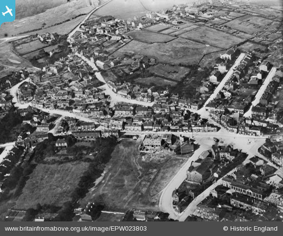
EPW023803 ENGLAND (1928). The town centre, Birstall, 1928. This image has been produced from a copy-negative.
© Copyright OpenStreetMap contributors and licensed by the OpenStreetMap Foundation. 2025. Cartography is licensed as CC BY-SA.
Nearby Images (4)
EPW023803

EPW023806

EPW023802

EPW023801

Details
| Title | [EPW023803] The town centre, Birstall, 1928. This image has been produced from a copy-negative. |
| Reference | EPW023803 |
| Date | September-1928 |
| Link | |
| Place name | BIRSTALL |
| Parish | |
| District | |
| Country | ENGLAND |
| Easting / Northing | 422416, 426296 |
| Longitude / Latitude | -1.6601721739632, 53.732352522742 |
| National Grid Reference | SE224263 |
Pins
 EE |
Tuesday 21st of September 2021 04:28:50 PM | |
EE |
Tuesday 21st of September 2021 04:28:30 PM | |
EE |
Tuesday 21st of September 2021 04:27:54 PM | |
EE |
Tuesday 21st of September 2021 04:27:20 PM | |
EE |
Tuesday 21st of September 2021 04:25:17 PM | |
EE |
Tuesday 21st of September 2021 04:24:58 PM | |
EE |
Tuesday 21st of September 2021 04:23:11 PM | |
EE |
Tuesday 21st of September 2021 04:22:50 PM | |
EE |
Tuesday 21st of September 2021 04:22:34 PM |