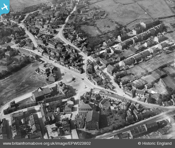
EPW023802 ENGLAND (1928). The Market Place and surroundings, Birstall, 1928
© Copyright OpenStreetMap contributors and licensed by the OpenStreetMap Foundation. 2024. Cartography is licensed as CC BY-SA.
Details
| Title | [EPW023802] The Market Place and surroundings, Birstall, 1928 |
| Reference | EPW023802 |
| Date | September-1928 |
| Link | |
| Place name | BIRSTALL |
| Parish | |
| District | |
| Country | ENGLAND |
| Easting / Northing | 422515, 426257 |
| Longitude / Latitude | -1.6586741973935, 53.731997688589 |
| National Grid Reference | SE225263 |
Pins
 kieron hill |
Wednesday 20th of July 2016 07:19:40 PM | |
 kieron hill |
Saturday 16th of July 2016 06:09:13 PM | |
 kieron hill |
Wednesday 15th of June 2016 08:09:51 PM | |
 Cabby |
Thursday 20th of March 2014 04:16:48 PM | |
 Cabby |
Wednesday 29th of May 2013 08:44:48 PM | |
 Cabby |
Wednesday 29th of May 2013 08:43:45 PM | |
 Cabby |
Wednesday 29th of May 2013 08:42:51 PM | |
 Cabby |
Wednesday 29th of May 2013 08:41:53 PM | |
 Cabby |
Wednesday 29th of May 2013 08:40:58 PM | |
 Cabby |
Tuesday 28th of August 2012 08:58:02 PM | |
 Cabby |
Tuesday 28th of August 2012 08:55:36 PM |


![[EPW023802] The Market Place and surroundings, Birstall, 1928](http://britainfromabove.org.uk/sites/all/libraries/aerofilms-images/public/100x100/EPW/023/EPW023802.jpg)
![[EPW023803] The town centre, Birstall, 1928. This image has been produced from a copy-negative.](http://britainfromabove.org.uk/sites/all/libraries/aerofilms-images/public/100x100/EPW/023/EPW023803.jpg)
![[EPW023806] The town centre, Birstall, 1928](http://britainfromabove.org.uk/sites/all/libraries/aerofilms-images/public/100x100/EPW/023/EPW023806.jpg)