
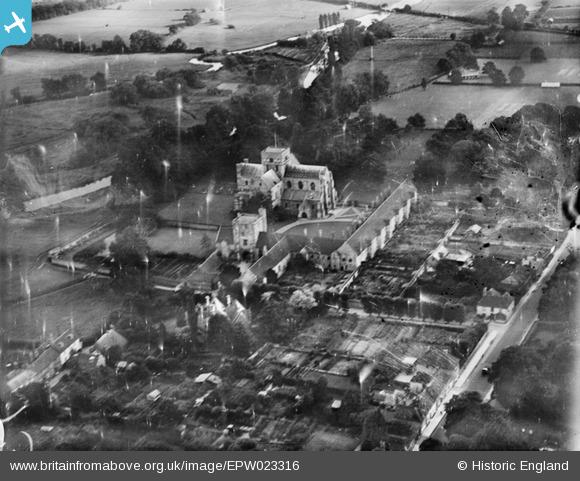
EPW023316 ENGLAND (1928). St Cross Church and hospital, St Cross, 1928
© Copyright OpenStreetMap contributors and licensed by the OpenStreetMap Foundation. 2026. Cartography is licensed as CC BY-SA.
Nearby Images (4)
EPW023316

EPW023320

EAW022312

EAW022313

Details
| Title | [EPW023316] St Cross Church and hospital, St Cross, 1928 |
| Reference | EPW023316 |
| Date | September-1928 |
| Link | |
| Place name | ST CROSS |
| Parish | |
| District | |
| Country | ENGLAND |
| Easting / Northing | 447614, 127768 |
| Longitude / Latitude | -1.3206927456429, 51.046750911573 |
| National Grid Reference | SU476278 |
Pins
Be the first to add a comment to this image!
User Comment Contributions
Looking south. For a modern view looking west, see http://www.geograph.org.uk/photo/40474 |

PeterFacey |
Tuesday 26th of June 2012 06:15:17 PM |