
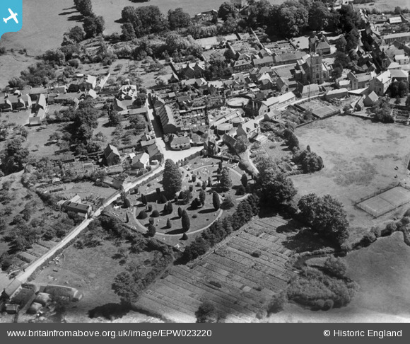
EPW023220 ENGLAND (1928). Gillingham Cemetery and Gas House Lane, Gillingham, 1928
© Copyright OpenStreetMap contributors and licensed by the OpenStreetMap Foundation. 2026. Cartography is licensed as CC BY-SA.
Nearby Images (4)
EPW023220

EPW033561

EPW023219

EPW033730

Details
| Title | [EPW023220] Gillingham Cemetery and Gas House Lane, Gillingham, 1928 |
| Reference | EPW023220 |
| Date | September-1928 |
| Link | |
| Place name | GILLINGHAM |
| Parish | GILLINGHAM |
| District | |
| Country | ENGLAND |
| Easting / Northing | 380530, 126680 |
| Longitude / Latitude | -2.2777279936934, 51.038610382591 |
| National Grid Reference | ST805267 |
Pins

Jaz |
Tuesday 15th of October 2013 12:16:45 AM | |
|
Jaz |
Tuesday 15th of October 2013 12:15:32 AM | |
|
Jaz |
Tuesday 15th of October 2013 12:14:51 AM | |

Class31 |
Wednesday 1st of August 2012 10:09:16 AM | |
|
Class31 |
Wednesday 1st of August 2012 10:08:17 AM | |
|
Class31 |
Wednesday 1st of August 2012 10:06:05 AM |
User Comment Contributions
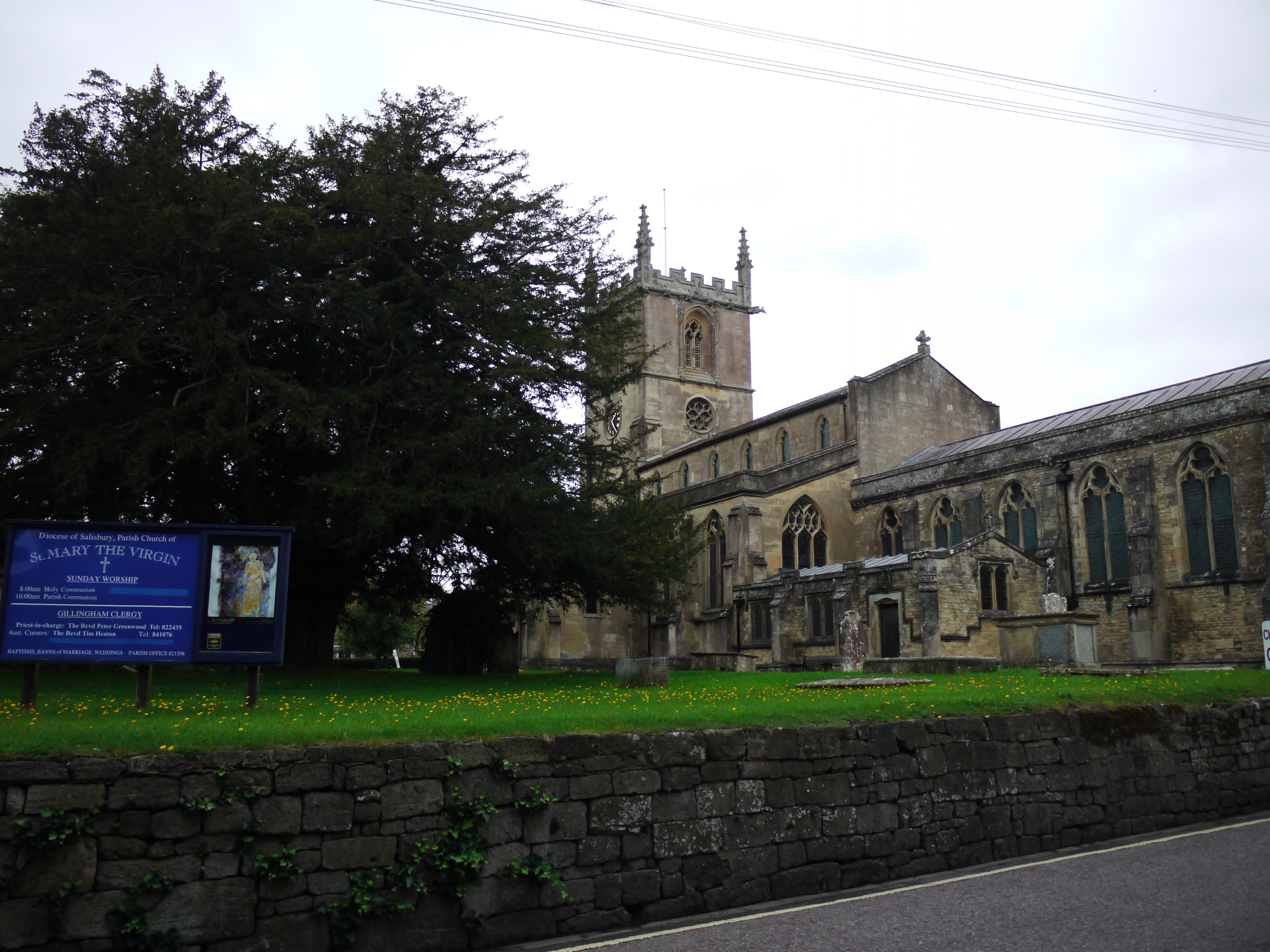
St. Mary's Church, Gillingham, 16/09/2015 |
Class31 |
Wednesday 16th of September 2015 04:52:27 PM |
View looking east. Gas House Lane appears to have gone out of use.(unless someone knows otherwise). The area has changed considerably with the construction of an inner relief road. |
Class31 |
Wednesday 1st of August 2012 10:12:44 AM |