
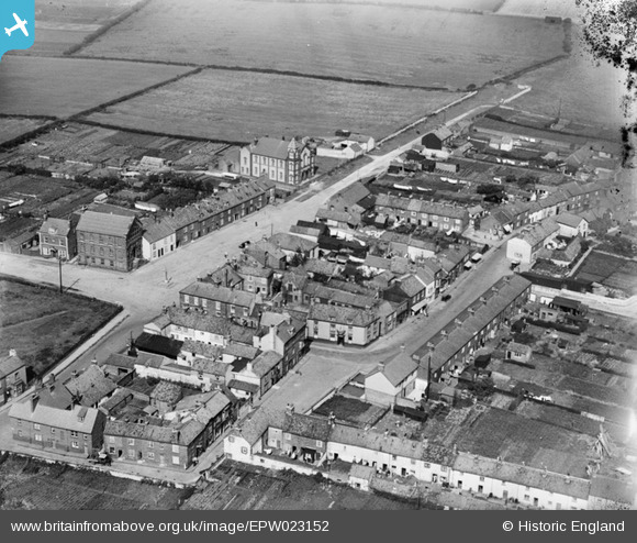
EPW023152 ENGLAND (1928). The village centre, Flamborough, 1928
© Copyright OpenStreetMap contributors and licensed by the OpenStreetMap Foundation. 2025. Cartography is licensed as CC BY-SA.
Nearby Images (4)
EPW023152

EPW023153

EPW039053

EPW039054

Details
| Title | [EPW023152] The village centre, Flamborough, 1928 |
| Reference | EPW023152 |
| Date | August-1928 |
| Link | |
| Place name | FLAMBOROUGH |
| Parish | FLAMBOROUGH |
| District | |
| Country | ENGLAND |
| Easting / Northing | 522703, 470623 |
| Longitude / Latitude | -0.12255013013854, 54.116638592031 |
| National Grid Reference | TA227706 |
Pins
Be the first to add a comment to this image!