
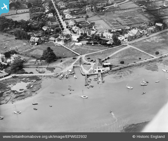
EPW022932 ENGLAND (1928). The Yacht Club and environs, Lymington, 1928
© Copyright OpenStreetMap contributors and licensed by the OpenStreetMap Foundation. 2026. Cartography is licensed as CC BY-SA.
Nearby Images (4)
EPW022932

EPW022936

EAW018161

EPW022931

Details
| Title | [EPW022932] The Yacht Club and environs, Lymington, 1928 |
| Reference | EPW022932 |
| Date | August-1928 |
| Link | |
| Place name | LYMINGTON |
| Parish | LYMINGTON AND PENNINGTON |
| District | |
| Country | ENGLAND |
| Easting / Northing | 433355, 95060 |
| Longitude / Latitude | -1.5271052448075, 50.753609180955 |
| National Grid Reference | SZ334951 |
Pins

Stefano |
Tuesday 18th of June 2013 10:09:27 AM | |
This is actually the balance pond which is now covered in concrete and is a dinghy park for RLymYc. The SWB is to the left of this picture and can be seen clearly in another of the 1928 pictures of Lymington. |
Merlin |
Sunday 25th of August 2013 05:53:20 PM |

Class31 |
Saturday 1st of December 2012 08:51:31 AM | |
|
Class31 |
Saturday 1st of December 2012 08:49:48 AM | |
|
Class31 |
Saturday 1st of December 2012 08:49:11 AM |