
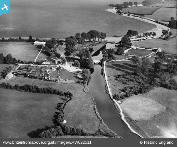
EPW022511 ENGLAND (1928). Godstow Bridge, Wolvercote, 1928
© Copyright OpenStreetMap contributors and licensed by the OpenStreetMap Foundation. 2026. Cartography is licensed as CC BY-SA.
Nearby Images (2)
EPW022511

EAW014896

Details
| Title | [EPW022511] Godstow Bridge, Wolvercote, 1928 |
| Reference | EPW022511 |
| Date | August-1928 |
| Link | |
| Place name | WOLVERCOTE |
| Parish | |
| District | |
| Country | ENGLAND |
| Easting / Northing | 448376, 209256 |
| Longitude / Latitude | -1.298699470138, 51.779425475766 |
| National Grid Reference | SP484093 |
Pins

Class31 |
Thursday 25th of October 2012 01:39:36 PM | |
|
Class31 |
Thursday 25th of October 2012 01:33:43 PM | |
|
Class31 |
Thursday 25th of October 2012 01:32:18 PM | |
|
Class31 |
Thursday 25th of October 2012 01:30:19 PM | |
|
Class31 |
Thursday 25th of October 2012 01:29:59 PM | |
|
Class31 |
Thursday 25th of October 2012 01:29:20 PM | |
|
Class31 |
Thursday 25th of October 2012 01:26:21 PM | |
|
Class31 |
Thursday 25th of October 2012 01:25:26 PM |
User Comment Contributions
View looking south. This location has been used in both the Morse and Lewis TV series. |
Class31 |
Thursday 25th of October 2012 01:35:00 PM |