
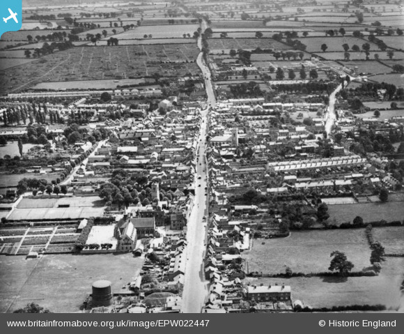
EPW022447 ENGLAND (1928). The High Street, Stony Stratford, 1928. This image has been produced from a copy-negative.
© Copyright OpenStreetMap contributors and licensed by the OpenStreetMap Foundation. 2026. Cartography is licensed as CC BY-SA.
Nearby Images (7)
EPW022447

EPW022449

EPW036316

EPW022450

EPW036313

EPW022485

EPW036315

Details
| Title | [EPW022447] The High Street, Stony Stratford, 1928. This image has been produced from a copy-negative. |
| Reference | EPW022447 |
| Date | August-1928 |
| Link | |
| Place name | STONY STRATFORD |
| Parish | STONY STRATFORD |
| District | |
| Country | ENGLAND |
| Easting / Northing | 478683, 240506 |
| Longitude / Latitude | -0.85227684745736, 52.056924111168 |
| National Grid Reference | SP787405 |
Pins

Vicky Holton |
Tuesday 19th of April 2016 03:44:34 PM |