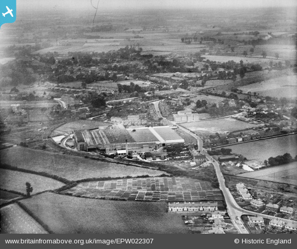
EPW022307 ENGLAND (1928). The Crittall Steel Works, Witham, from the north-west, 1928
© Copyright OpenStreetMap contributors and licensed by the OpenStreetMap Foundation. 2026. Cartography is licensed as CC BY-SA.
Details
| Title | [EPW022307] The Crittall Steel Works, Witham, from the north-west, 1928 |
| Reference | EPW022307 |
| Date | August-1928 |
| Link | |
| Place name | WITHAM |
| Parish | WITHAM |
| District | |
| Country | ENGLAND |
| Easting / Northing | 582061, 215733 |
| Longitude / Latitude | 0.64130951462144, 51.8100909746 |
| National Grid Reference | TL821157 |


![[EPW022307] The Crittall Steel Works, Witham, from the north-west, 1928](http://britainfromabove.org.uk/sites/all/libraries/aerofilms-images/public/100x100/EPW/022/EPW022307.jpg)
![[EAW030768] Witham Cemetery and Witham Junction, Witham, 1950. This image was marked by Aerofilms Ltd for photo editing.](http://britainfromabove.org.uk/sites/all/libraries/aerofilms-images/public/100x100/EAW/030/EAW030768.jpg)
![[EAW030771] The Crittall Steel Works and environs, Witham, 1950. This image was marked by Aerofilms Ltd for photo editing.](http://britainfromabove.org.uk/sites/all/libraries/aerofilms-images/public/100x100/EAW/030/EAW030771.jpg)
