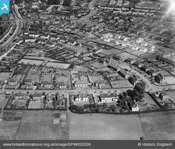
EPW022036 ENGLAND (1928). High Oaks Road and Dognell Green housing, Welwyn Garden City, 1928
© Copyright OpenStreetMap contributors and licensed by the OpenStreetMap Foundation. 2026. Cartography is licensed as CC BY-SA.
Nearby Images (5)
Details
| Title | [EPW022036] High Oaks Road and Dognell Green housing, Welwyn Garden City, 1928 |
| Reference | EPW022036 |
| Date | July-1928 |
| Link | |
| Place name | WELWYN GARDEN CITY |
| Parish | |
| District | |
| Country | ENGLAND |
| Easting / Northing | 522898, 213124 |
| Longitude / Latitude | -0.21738611084818, 51.802785979945 |
| National Grid Reference | TL229131 |
Pins

Ursula |
Monday 28th of January 2019 01:57:48 AM | |

Ursula |
Monday 28th of January 2019 01:56:54 AM | |

Ursula |
Monday 28th of January 2019 01:56:07 AM | |

Ursula |
Monday 28th of January 2019 01:55:19 AM | |

Ursula |
Monday 28th of January 2019 01:53:28 AM | |

Ursula |
Monday 28th of January 2019 01:46:20 AM | |

Ursula |
Monday 28th of January 2019 01:41:50 AM |


![[EPW022036] High Oaks Road and Dognell Green housing, Welwyn Garden City, 1928](http://britainfromabove.org.uk/sites/all/libraries/aerofilms-images/public/100x100/EPW/022/EPW022036.jpg)
![[EPW054543] The residential area surrounding Brockett Close, Dognell Green and Dellcott Close, Handside, 1937](http://britainfromabove.org.uk/sites/all/libraries/aerofilms-images/public/100x100/EPW/054/EPW054543.jpg)
![[EPW009818] Brockswood Lane, Welwyn Garden City, 1924](http://britainfromabove.org.uk/sites/all/libraries/aerofilms-images/public/100x100/EPW/009/EPW009818.jpg)
![[EPW022029] The Town Centre, Welwyn Garden City, from the west, 1928](http://britainfromabove.org.uk/sites/all/libraries/aerofilms-images/public/100x100/EPW/022/EPW022029.jpg)
![[EPW009816] Valley Road and surroundings, Welwyn Garden City, 1924](http://britainfromabove.org.uk/sites/all/libraries/aerofilms-images/public/100x100/EPW/009/EPW009816.jpg)