
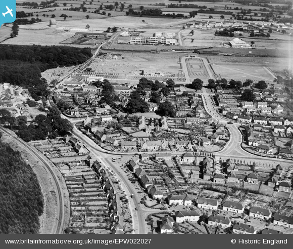
EPW022027 ENGLAND (1928). The Town Centre, Welwyn Garden City, 1928
© Copyright OpenStreetMap contributors and licensed by the OpenStreetMap Foundation. 2026. Cartography is licensed as CC BY-SA.
Nearby Images (15)
EPW022027

EAW013992

EPW013424

EPW022018

EPW047356

EPW047366

EPW047369

EPW047368

EPW047367

EPW022030

EPW047357

EPW047379

EAW013994

EPW054540

EPW054542

Details
| Title | [EPW022027] The Town Centre, Welwyn Garden City, 1928 |
| Reference | EPW022027 |
| Date | July-1928 |
| Link | |
| Place name | WELWYN GARDEN CITY |
| Parish | |
| District | |
| Country | ENGLAND |
| Easting / Northing | 523347, 213171 |
| Longitude / Latitude | -0.21086013801702, 51.803109516795 |
| National Grid Reference | TL233132 |
Pins

Paul |
Monday 26th of August 2013 04:46:06 PM | |
|
Duncan Cameron |
Monday 14th of January 2013 09:07:33 PM | |
|
mister_a |
Thursday 28th of June 2012 10:03:09 PM |