
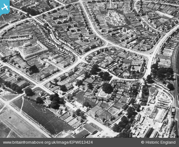
EPW013424 ENGLAND (1925). The residential area surrounding Russellcroft Road, Welwyn Garden City, 1925. This image has been produced from a copy-negative.
© Copyright OpenStreetMap contributors and licensed by the OpenStreetMap Foundation. 2026. Cartography is licensed as CC BY-SA.
Nearby Images (18)
EPW013424

EAW013992

EPW022027

EPW022018

EPW047356

EPW022030

EPW047369

EPW047367

EPW047368

EPW047366

EPW047357

EPW047379

EPW054540

EPW054542

EPW054540A

EAW013994

EPW025536

EPW062050

Details
| Title | [EPW013424] The residential area surrounding Russellcroft Road, Welwyn Garden City, 1925. This image has been produced from a copy-negative. |
| Reference | EPW013424 |
| Date | June-1925 |
| Link | |
| Place name | WELWYN GARDEN CITY |
| Parish | |
| District | |
| Country | ENGLAND |
| Easting / Northing | 523362, 213120 |
| Longitude / Latitude | -0.21066083072603, 51.802647836771 |
| National Grid Reference | TL234131 |
Pins
Be the first to add a comment to this image!