
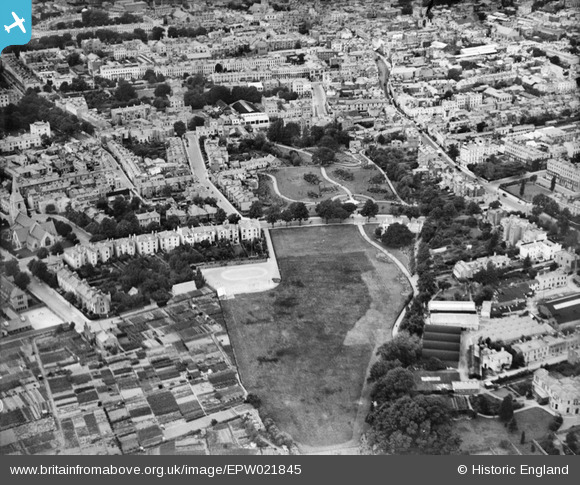
EPW021845 ENGLAND (1928). Sandford Park, Cheltenham, 1928
© Copyright OpenStreetMap contributors and licensed by the OpenStreetMap Foundation. 2026. Cartography is licensed as CC BY-SA.
Nearby Images (13)
EPW021845

EPW021848

EPW021850

EPW021846

EPW021849

EPW021844

EPW021847

EPW021843

EPW000167

EAW006520

EAW006519

EAW006517

EAW006521

Details
| Title | [EPW021845] Sandford Park, Cheltenham, 1928 |
| Reference | EPW021845 |
| Date | July-1928 |
| Link | |
| Place name | CHELTENHAM |
| Parish | |
| District | |
| Country | ENGLAND |
| Easting / Northing | 395217, 221904 |
| Longitude / Latitude | -2.0695162222303, 51.895227175451 |
| National Grid Reference | SO952219 |
Pins

Paul D Scott |
Tuesday 28th of July 2015 03:45:32 PM |
User Comment Contributions

Park entrance from High Street 27/09/2013 |

Class31 |
Sunday 29th of September 2013 08:12:05 PM |