
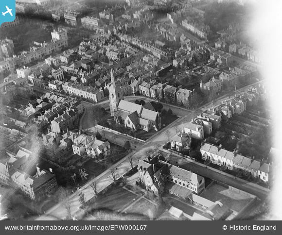
EPW000167 ENGLAND (1920). St Luke's Church, Cheltenham, 1920
© Copyright OpenStreetMap contributors and licensed by the OpenStreetMap Foundation. 2026. Cartography is licensed as CC BY-SA.
Nearby Images (16)
EPW000167

EPW021847

EPW021843

EPW021845

EPW021848

EPW021850

EAW006517

EPW021849

EAW006519

EAW006520

EPW048199
, Cheltenham, 1935")
EPW021844

EPW021846

EAW006518

EPW048198
, Cheltenham, 1935")
EAW006521

Details
| Title | [EPW000167] St Luke's Church, Cheltenham, 1920 |
| Reference | EPW000167 |
| Date | February-1920 |
| Link | |
| Place name | CHELTENHAM |
| Parish | |
| District | |
| Country | ENGLAND |
| Easting / Northing | 395086, 221802 |
| Longitude / Latitude | -2.0714187233368, 51.894308862212 |
| National Grid Reference | SO951218 |
Pins

Class31 |
Monday 11th of November 2013 01:43:26 PM |


